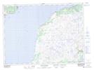
Maps showing Horn Hill, Newfoundland and Labrador
Horn Hill is a Mountain located in Newfoundland and Labrador and has an elevation of 178 meters.
- Latitude: 47° 18' 49'' North (decimal: 47.3136111)
- Longitude: 55° 10' 10'' West (decimal: -55.1694444)
- Topography Feature Category: Mountain
- Geographical Feature: Hill
- Canadian Province/Territory: Newfoundland and Labrador
- Elevation: 178 meters
- Atlas of Canada Locator Map: Horn Hill
- GPS Coordinate Locator Map: Horn Hill Lat/Long
Horn Hill NTS Map Sheets