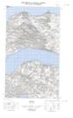
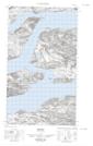
Maps showing Horse Chops Hill, Newfoundland and Labrador
Horse Chops Hill is a Mountain located in Newfoundland and Labrador.
- Latitude: 54° 10' 00'' North (decimal: 54.1666666)
- Longitude: 58° 19' 57'' West (decimal: -58.3325000)
- Topography Feature Category: Mountain
- Geographical Feature: Hill
- Canadian Province/Territory: Newfoundland and Labrador
- Atlas of Canada Locator Map: Horse Chops Hill
- GPS Coordinate Locator Map: Horse Chops Hill Lat/Long
Horse Chops Hill NTS Map Sheets