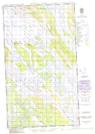
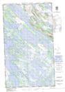
Maps showing Hughes Lake, Newfoundland and Labrador
Hughes Lake is a Lake located in Newfoundland and Labrador and has an elevation of 482 meters.
- Latitude: 54° 30' 0'' North (decimal: 54.5000916)
- Longitude: 66° 12' 57'' West (decimal: -66.2159215)
- Topography Feature Category: Lake
- Geographical Feature: Lake
- Canadian Province/Territory: Newfoundland and Labrador
- Elevation: 482 meters
- Atlas of Canada Locator Map: Hughes Lake
- GPS Coordinate Locator Map: Hughes Lake Lat/Long
Hughes Lake NTS Map Sheets