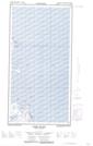
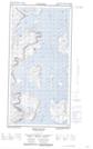
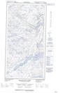
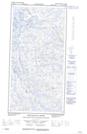
Maps showing Ikkudliayuk Fiord, Newfoundland and Labrador
Ikkudliayuk Fiord is a Bay located in Newfoundland and Labrador and has an elevation of 5 meters.
- Latitude: 60° 4' 18'' North (decimal: 60.0715812)
- Longitude: 64° 29' 59'' West (decimal: -64.4996967)
- Topography Feature Category: Bay
- Geographical Feature: Fiord
- Canadian Province/Territory: Newfoundland and Labrador
- Elevation: 5 meters
- Atlas of Canada Locator Map: Ikkudliayuk Fiord
- GPS Coordinate Locator Map: Ikkudliayuk Fiord Lat/Long
Ikkudliayuk Fiord NTS Map Sheets