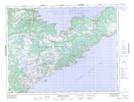
Maps showing Indian Burying Place, Newfoundland and Labrador
Indian Burying Place is a Unincorporated area located in Newfoundland and Labrador and has an elevation of 60 meters.
- Latitude: 49° 49' 42'' North (decimal: 49.8283333)
- Longitude: 55° 44' 24'' West (decimal: -55.7399999)
- Topography Feature Category: Unincorporated area
- Geographical Feature: Vacated or Seasonal Settlement
- Canadian Province/Territory: Newfoundland and Labrador
- Elevation: 60 meters
- Atlas of Canada Locator Map: Indian Burying Place
- GPS Coordinate Locator Map: Indian Burying Place Lat/Long
Indian Burying Place NTS Map Sheets