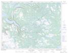
Maps showing Indian Lookout, Newfoundland and Labrador
Indian Lookout is a Mountain located in Newfoundland and Labrador and has an elevation of 448 meters.
- Latitude: 50° 7' 34'' North (decimal: 50.1261111)
- Longitude: 57° 25' 53'' West (decimal: -57.4313888)
- Topography Feature Category: Mountain
- Geographical Feature: Lookout
- Canadian Province/Territory: Newfoundland and Labrador
- Elevation: 448 meters
- Atlas of Canada Locator Map: Indian Lookout
- GPS Coordinate Locator Map: Indian Lookout Lat/Long
Indian Lookout NTS Map Sheets