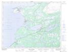
Maps showing Indian Steady, Newfoundland and Labrador
Indian Steady is a Lake located in Newfoundland and Labrador and has an elevation of 69 meters.
- Latitude: 50° 40' 34'' North (decimal: 50.6761111)
- Longitude: 57° 13' 27'' West (decimal: -57.2241666)
- Topography Feature Category: Lake
- Geographical Feature: Steady
- Canadian Province/Territory: Newfoundland and Labrador
- Elevation: 69 meters
- Atlas of Canada Locator Map: Indian Steady
- GPS Coordinate Locator Map: Indian Steady Lat/Long
Indian Steady NTS Map Sheets