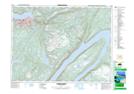
Maps showing Inner Aspen Point, Newfoundland and Labrador
Inner Aspen Point is a Cape located in Newfoundland and Labrador and has an elevation of 83 meters.
- Latitude: 48° 58' 41'' North (decimal: 48.9780555)
- Longitude: 57° 57' 5'' West (decimal: -57.9513888)
- Topography Feature Category: Cape
- Geographical Feature: Point
- Canadian Province/Territory: Newfoundland and Labrador
- Elevation: 83 meters
- Atlas of Canada Locator Map: Inner Aspen Point
- GPS Coordinate Locator Map: Inner Aspen Point Lat/Long
Inner Aspen Point NTS Map Sheets