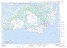
Maps showing Ireland's Bight, Newfoundland and Labrador
Ireland's Bight is a Unincorporated area located in Newfoundland and Labrador.
- Latitude: 51° 20' 00'' North (decimal: 51.3333333)
- Longitude: 55° 45' 56'' West (decimal: -55.7655553)
- Topography Feature Category: Unincorporated area
- Geographical Feature: Vacated or Seasonal Settlement
- Canadian Province/Territory: Newfoundland and Labrador
- Atlas of Canada Locator Map: Ireland's Bight
- GPS Coordinate Locator Map: Ireland's Bight Lat/Long
Ireland's Bight NTS Map Sheets