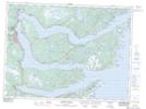
Maps showing Ireland's Eye Harbour, Newfoundland and Labrador
Ireland's Eye Harbour is a Bay located in Newfoundland and Labrador and has an elevation of 17 meters.
- Latitude: 48° 12' 51'' North (decimal: 48.2141666)
- Longitude: 53° 29' 35'' West (decimal: -53.4930555)
- Topography Feature Category: Bay
- Geographical Feature: Harbour
- Canadian Province/Territory: Newfoundland and Labrador
- Elevation: 17 meters
- Atlas of Canada Locator Map: Ireland's Eye Harbour
- GPS Coordinate Locator Map: Ireland's Eye Harbour Lat/Long
Ireland's Eye Harbour NTS Map Sheets