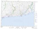
Maps showing Isle aux Morts Harbour, La Poile, Newfoundland and Labrador
Isle aux Morts Harbour is a Bay located in La Poile, Newfoundland and Labrador and has an elevation of 1 meters.
- Latitude: 47° 35' 0'' North (decimal: 47.5834671)
- Longitude: 58° 59' 57'' West (decimal: -58.9990889)
- Topography Feature Category: Bay
- Geographical Feature: Harbour
- Canadian Province/Territory: Newfoundland and Labrador
- Elevation: 1 meters
- Location: La Poile
- Atlas of Canada Locator Map: Isle aux Morts Harbour
- GPS Coordinate Locator Map: Isle aux Morts Harbour Lat/Long
Isle aux Morts Harbour NTS Map Sheets