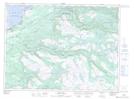
Maps showing Jack Joes Pond, Newfoundland and Labrador
Jack Joes Pond is a Lake located in Newfoundland and Labrador and has an elevation of 321 meters.
- Latitude: 48° 24' 42'' North (decimal: 48.4116666)
- Longitude: 58° 4' 51'' West (decimal: -58.0808333)
- Topography Feature Category: Lake
- Geographical Feature: Pond
- Canadian Province/Territory: Newfoundland and Labrador
- Elevation: 321 meters
- Atlas of Canada Locator Map: Jack Joes Pond
- GPS Coordinate Locator Map: Jack Joes Pond Lat/Long
Jack Joes Pond NTS Map Sheets