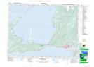
Maps showing Jerrys Nose, Port au Port, Newfoundland and Labrador
Jerrys Nose is a Unincorporated area located in Port au Port, Newfoundland and Labrador and has an elevation of 17 meters.
- Latitude: 48° 30' 59'' North (decimal: 48.5163888)
- Longitude: 58° 56' 26'' West (decimal: -58.9405555)
- Topography Feature Category: Unincorporated area
- Geographical Feature: Neighbourhood
- Canadian Province/Territory: Newfoundland and Labrador
- Elevation: 17 meters
- Location: Port au Port
- Atlas of Canada Locator Map: Jerrys Nose
- GPS Coordinate Locator Map: Jerrys Nose Lat/Long
Jerrys Nose NTS Map Sheets