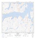
Maps showing Jerusalem Harbour, Newfoundland and Labrador
Jerusalem Harbour is a Bay located in Newfoundland and Labrador and has an elevation of 19 meters.
- Latitude: 58° 13' 45'' North (decimal: 58.2290374)
- Longitude: 62° 37' 26'' West (decimal: -62.6239836)
- Topography Feature Category: Bay
- Geographical Feature: Harbour
- Canadian Province/Territory: Newfoundland and Labrador
- Elevation: 19 meters
- Atlas of Canada Locator Map: Jerusalem Harbour
- GPS Coordinate Locator Map: Jerusalem Harbour Lat/Long