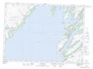
Maps showing Jigging Cove, St. Mary's-The Capes, Newfoundland and Labrador
Jigging Cove is a Bay located in St. Mary's-The Capes, Newfoundland and Labrador and has an elevation of 2 meters.
- Latitude: 46° 56' 41'' North (decimal: 46.9447222)
- Longitude: 53° 51' 43'' West (decimal: -53.8619444)
- Topography Feature Category: Bay
- Geographical Feature: Cove
- Canadian Province/Territory: Newfoundland and Labrador
- Elevation: 2 meters
- Location: St. Mary's-The Capes
- Atlas of Canada Locator Map: Jigging Cove
- GPS Coordinate Locator Map: Jigging Cove Lat/Long
Jigging Cove NTS Map Sheets