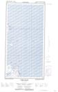
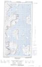
Maps showing Jolliet Inlet, Newfoundland and Labrador
Jolliet Inlet is a Bay located in Newfoundland and Labrador and has an elevation of 30 meters.
- Latitude: 60° 12' 9'' North (decimal: 60.2025250)
- Longitude: 64° 24' 8'' West (decimal: -64.4021857)
- Topography Feature Category: Bay
- Geographical Feature: Inlet
- Canadian Province/Territory: Newfoundland and Labrador
- Elevation: 30 meters
- Atlas of Canada Locator Map: Jolliet Inlet
- GPS Coordinate Locator Map: Jolliet Inlet Lat/Long
Jolliet Inlet NTS Map Sheets