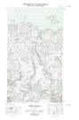
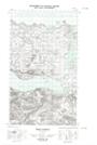
Maps showing Kellick Point, Newfoundland and Labrador
Kellick Point is a Cape located in Newfoundland and Labrador.
- Latitude: 54° 13' 8'' North (decimal: 54.2189449)
- Longitude: 57° 52' 50'' West (decimal: -57.8806208)
- Topography Feature Category: Cape
- Geographical Feature: Point
- Canadian Province/Territory: Newfoundland and Labrador
- Atlas of Canada Locator Map: Kellick Point
- GPS Coordinate Locator Map: Kellick Point Lat/Long
Kellick Point NTS Map Sheets