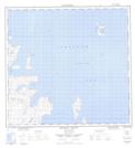
Maps showing Kruth Island, Newfoundland and Labrador
Kruth Island is a Island located in Newfoundland and Labrador and has an elevation of 0 meters.
- Latitude: 58° 9' 37'' North (decimal: 58.1602727)
- Longitude: 62° 23' 30'' West (decimal: -62.3917953)
- Topography Feature Category: Island
- Geographical Feature: Island
- Canadian Province/Territory: Newfoundland and Labrador
- Elevation: 0 meters
- Atlas of Canada Locator Map: Kruth Island
- GPS Coordinate Locator Map: Kruth Island Lat/Long
Kruth Island NTS Map Sheets