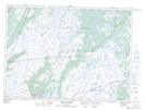
Maps showing Laden Field's Brook, Newfoundland and Labrador
Laden Field's Brook is a River located in Newfoundland and Labrador and has an elevation of 179 meters.
- Latitude: 46° 51' 35'' North (decimal: 46.8597222)
- Longitude: 53° 24' 23'' West (decimal: -53.4063888)
- Topography Feature Category: River
- Geographical Feature: Brook
- Canadian Province/Territory: Newfoundland and Labrador
- Elevation: 179 meters
- Atlas of Canada Locator Map: Laden Field's Brook
- GPS Coordinate Locator Map: Laden Field's Brook Lat/Long
Laden Field's Brook NTS Map Sheets