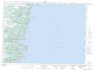
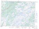
Maps showing La Manche River, Newfoundland and Labrador
La Manche River is a River located in Newfoundland and Labrador and has an elevation of 106 meters.
- Latitude: 47° 9' 57'' North (decimal: 47.1657999)
- Longitude: 52° 51' 59'' West (decimal: -52.8663999)
- Topography Feature Category: River
- Geographical Feature: River
- Canadian Province/Territory: Newfoundland and Labrador
- Elevation: 106 meters
- Atlas of Canada Locator Map: La Manche River
- GPS Coordinate Locator Map: La Manche River Lat/Long
La Manche River NTS Map Sheets