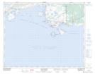
Maps showing L'Anse-au-Clair, Newfoundland and Labrador
L'Anse-au-Clair is a Town located in Newfoundland and Labrador and has an elevation of 52 meters.
- Latitude: 51° 27' 49'' North (decimal: 51.4637361)
- Longitude: 57° 4' 2'' West (decimal: -57.0670944)
- Topography Feature Category: Town
- Geographical Feature: Town
- Canadian Province/Territory: Newfoundland and Labrador
- Elevation: 52 meters
- Atlas of Canada Locator Map: L'Anse-au-Clair
- GPS Coordinate Locator Map: L'Anse-au-Clair Lat/Long
L'Anse-au-Clair NTS Map Sheets