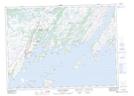
Maps showing Larkin Shoal, Newfoundland and Labrador
Larkin Shoal is a Shoal located in Newfoundland and Labrador.
- Latitude: 47° 19' 25'' North (decimal: 47.3236111)
- Longitude: 54° 37' 37'' West (decimal: -54.6269444)
- Topography Feature Category: Shoal
- Geographical Feature: Shoal
- Canadian Province/Territory: Newfoundland and Labrador
- Atlas of Canada Locator Map: Larkin Shoal
- GPS Coordinate Locator Map: Larkin Shoal Lat/Long
Larkin Shoal NTS Map Sheets