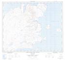
Maps showing Lister Island, Newfoundland and Labrador
Lister Island is a Island located in Newfoundland and Labrador and has an elevation of 0 meters.
- Latitude: 58° 24' 28'' North (decimal: 58.4077102)
- Longitude: 62° 36' 48'' West (decimal: -62.6132593)
- Topography Feature Category: Island
- Geographical Feature: Island
- Canadian Province/Territory: Newfoundland and Labrador
- Elevation: 0 meters
- Atlas of Canada Locator Map: Lister Island
- GPS Coordinate Locator Map: Lister Island Lat/Long
Lister Island NTS Map Sheets