Maps showing Little Adlavik Harbour, Newfoundland and Labrador
Little Adlavik Harbour is a Bay located in Newfoundland and Labrador.
- Latitude: 54° 56' 6'' North (decimal: 54.9350366)
- Longitude: 58° 40' 13'' West (decimal: -58.6703555)
- Topography Feature Category: Bay
- Geographical Feature: Cove
- Canadian Province/Territory: Newfoundland and Labrador
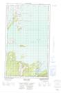
- Atlas of Canada Locator Map: Little Adlavik Harbour
- GPS Coordinate Locator Map: Little Adlavik Harbour Lat/Long
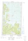
Little Adlavik Harbour NTS Map Sheets