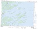
Maps showing Little Barr Island, Newfoundland and Labrador
Little Barr Island is a Island located in Newfoundland and Labrador and has an elevation of 3 meters.
- Latitude: 48° 58' 16'' North (decimal: 48.9711111)
- Longitude: 53° 53' 51'' West (decimal: -53.8975000)
- Topography Feature Category: Island
- Geographical Feature: Island
- Canadian Province/Territory: Newfoundland and Labrador
- Elevation: 3 meters
- Atlas of Canada Locator Map: Little Barr Island
- GPS Coordinate Locator Map: Little Barr Island Lat/Long
Little Barr Island NTS Map Sheets