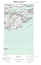
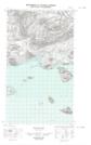
Maps showing Little Black Island, Newfoundland and Labrador
Little Black Island is a Island located in Newfoundland and Labrador and has an elevation of 22 meters.
- Latitude: 54° 18' 5'' North (decimal: 54.3012518)
- Longitude: 57° 49' 54'' West (decimal: -57.8317743)
- Topography Feature Category: Island
- Geographical Feature: Island
- Canadian Province/Territory: Newfoundland and Labrador
- Elevation: 22 meters
- Atlas of Canada Locator Map: Little Black Island
- GPS Coordinate Locator Map: Little Black Island Lat/Long
Little Black Island NTS Map Sheets