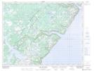
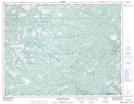
Maps showing Little Harbour Deep, Newfoundland and Labrador
Little Harbour Deep is a Unincorporated area located in Newfoundland and Labrador and has an elevation of 115 meters.
- Latitude: 50° 14' 58'' North (decimal: 50.2494444)
- Longitude: 56° 33' 15'' West (decimal: -56.5541666)
- Topography Feature Category: Unincorporated area
- Geographical Feature: Vacated or Seasonal Settlement
- Canadian Province/Territory: Newfoundland and Labrador
- Elevation: 115 meters
- Atlas of Canada Locator Map: Little Harbour Deep
- GPS Coordinate Locator Map: Little Harbour Deep Lat/Long
Little Harbour Deep NTS Map Sheets