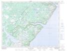
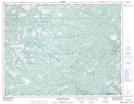
Maps showing Little Harbour Deep, Newfoundland and Labrador
Little Harbour Deep is a Bay located in Newfoundland and Labrador and has an elevation of 53 meters.
- Latitude: 50° 14' 35'' North (decimal: 50.2430555)
- Longitude: 56° 32' 3'' West (decimal: -56.5341666)
- Topography Feature Category: Bay
- Geographical Feature: Harbour
- Canadian Province/Territory: Newfoundland and Labrador
- Elevation: 53 meters
- Atlas of Canada Locator Map: Little Harbour Deep
- GPS Coordinate Locator Map: Little Harbour Deep Lat/Long
Little Harbour Deep NTS Map Sheets