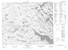
Maps showing Little Juniper Island, Newfoundland and Labrador
Little Juniper Island is a Island located in Newfoundland and Labrador.
- Latitude: 52° 45' 22'' North (decimal: 52.7561228)
- Longitude: 56° 1' 10'' West (decimal: -56.0194271)
- Topography Feature Category: Island
- Geographical Feature: Island
- Canadian Province/Territory: Newfoundland and Labrador
- Atlas of Canada Locator Map: Little Juniper Island
- GPS Coordinate Locator Map: Little Juniper Island Lat/Long
Little Juniper Island NTS Map Sheets