Maps showing Lobster Harbour, Newfoundland and Labrador
Lobster Harbour is a Unincorporated area located in Newfoundland and Labrador.
- Latitude: 49° 36' 14'' North (decimal: 49.6038888)
- Longitude: 54° 41' 1'' West (decimal: -54.6836111)
- Topography Feature Category: Unincorporated area
- Geographical Feature: Vacated or Seasonal Settlement
- Canadian Province/Territory: Newfoundland and Labrador
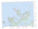
- Atlas of Canada Locator Map: Lobster Harbour
- GPS Coordinate Locator Map: Lobster Harbour Lat/Long
Lobster Harbour NTS Map Sheets