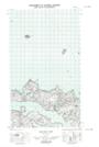
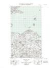
Maps showing Lookout Rocks, Newfoundland and Labrador
Lookout Rocks is a Shoal located in Newfoundland and Labrador.
- Latitude: 53° 39' 33'' North (decimal: 53.6592677)
- Longitude: 56° 23' 9'' West (decimal: -56.3857521)
- Topography Feature Category: Shoal
- Geographical Feature: Rocks
- Canadian Province/Territory: Newfoundland and Labrador
- Atlas of Canada Locator Map: Lookout Rocks
- GPS Coordinate Locator Map: Lookout Rocks Lat/Long
Lookout Rocks NTS Map Sheets