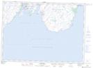
Maps showing The Look Out, Newfoundland and Labrador
The Look Out is a Mountain located in Newfoundland and Labrador and has an elevation of 12 meters.
- Latitude: 46° 43' 11'' North (decimal: 46.7197222)
- Longitude: 53° 22' 51'' West (decimal: -53.3808333)
- Topography Feature Category: Mountain
- Geographical Feature: Lookout
- Canadian Province/Territory: Newfoundland and Labrador
- Elevation: 12 meters
- Atlas of Canada Locator Map: The Look Out
- GPS Coordinate Locator Map: The Look Out Lat/Long
The Look Out NTS Map Sheets