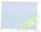
Maps showing Loretto, Port au Port, Newfoundland and Labrador
Loretto is a Unincorporated area located in Port au Port, Newfoundland and Labrador.
- Latitude: 48° 30' 00'' North (decimal: 48.4999999)
- Longitude: 59° 8' 57'' West (decimal: -59.1491666)
- Topography Feature Category: Unincorporated area
- Geographical Feature: Neighbourhood
- Canadian Province/Territory: Newfoundland and Labrador
- Location: Port au Port
- Atlas of Canada Locator Map: Loretto
- GPS Coordinate Locator Map: Loretto Lat/Long
Loretto NTS Map Sheets