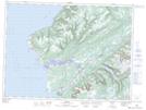
Maps showing Low Brook, Newfoundland and Labrador
Low Brook is a River located in Newfoundland and Labrador and has an elevation of 78 meters.
- Latitude: 47° 56' 24'' North (decimal: 47.9400000)
- Longitude: 59° 19' 53'' West (decimal: -59.3313888)
- Topography Feature Category: River
- Geographical Feature: Brook
- Canadian Province/Territory: Newfoundland and Labrador
- Elevation: 78 meters
- Atlas of Canada Locator Map: Low Brook
- GPS Coordinate Locator Map: Low Brook Lat/Long
Low Brook NTS Map Sheets