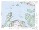
Maps showing Lower Berth Cove, Newfoundland and Labrador
Lower Berth Cove is a Bay located in Newfoundland and Labrador and has an elevation of 79 meters.
- Latitude: 49° 15' 14'' North (decimal: 49.2538888)
- Longitude: 58° 13' 39'' West (decimal: -58.2275000)
- Topography Feature Category: Bay
- Geographical Feature: Cove
- Canadian Province/Territory: Newfoundland and Labrador
- Elevation: 79 meters
- Atlas of Canada Locator Map: Lower Berth Cove
- GPS Coordinate Locator Map: Lower Berth Cove Lat/Long
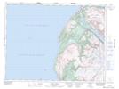
Lower Berth Cove NTS Map Sheets