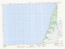
Maps showing Lower Big Shoal, Newfoundland and Labrador
Lower Big Shoal is a Shoal located in Newfoundland and Labrador.
- Latitude: 47° 14' 23'' North (decimal: 47.2397222)
- Longitude: 54° 24' 51'' West (decimal: -54.4141666)
- Topography Feature Category: Shoal
- Geographical Feature: Shoal
- Canadian Province/Territory: Newfoundland and Labrador
- Atlas of Canada Locator Map: Lower Big Shoal
- GPS Coordinate Locator Map: Lower Big Shoal Lat/Long
Lower Big Shoal NTS Map Sheets