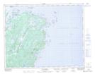
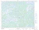
Maps showing Main Brook, Newfoundland and Labrador
Main Brook is a Town located in Newfoundland and Labrador and has an elevation of 9 meters.
- Latitude: 51° 9' 55'' North (decimal: 51.1652527)
- Longitude: 55° 59' 15'' West (decimal: -55.9875694)
- Topography Feature Category: Town
- Geographical Feature: Town
- Canadian Province/Territory: Newfoundland and Labrador
- Elevation: 9 meters
- Atlas of Canada Locator Map: Main Brook
- GPS Coordinate Locator Map: Main Brook Lat/Long
Main Brook NTS Map Sheets