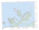
Maps showing Merritts Harbour, Newfoundland and Labrador
Merritts Harbour is a Unincorporated area located in Newfoundland and Labrador.
- Latitude: 49° 35' 00'' North (decimal: 49.5833333)
- Longitude: 54° 40' 57'' West (decimal: -54.6825000)
- Topography Feature Category: Unincorporated area
- Geographical Feature: Settlement
- Canadian Province/Territory: Newfoundland and Labrador
- GPS Coordinate Locator Map: Merritts Harbour Lat/Long
Merritts Harbour NTS Map Sheets