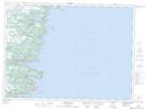
Maps showing Mobile, Ferryland, Newfoundland and Labrador
Mobile is a Unincorporated area located in Ferryland, Newfoundland and Labrador and has an elevation of 28 meters.
- Latitude: 47° 15' 00'' North (decimal: 47.2499999)
- Longitude: 52° 50' 56'' West (decimal: -52.8488888)
- Topography Feature Category: Unincorporated area
- Geographical Feature: Local Service District
- Canadian Province/Territory: Newfoundland and Labrador
- Elevation: 28 meters
- Location: Ferryland
- Atlas of Canada Locator Map: Mobile
- GPS Coordinate Locator Map: Mobile Lat/Long
Mobile NTS Map Sheets