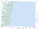
Maps showing Mobile First Pond, Newfoundland and Labrador
Mobile First Pond is a Lake located in Newfoundland and Labrador and has an elevation of 117 meters.
- Latitude: 47° 15' 12'' North (decimal: 47.2533333)
- Longitude: 52° 54' 37'' West (decimal: -52.9102777)
- Topography Feature Category: Lake
- Geographical Feature: Pond
- Canadian Province/Territory: Newfoundland and Labrador
- Elevation: 117 meters
- Atlas of Canada Locator Map: Mobile First Pond
- GPS Coordinate Locator Map: Mobile First Pond Lat/Long
Mobile First Pond NTS Map Sheets