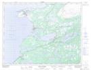
Maps showing Morue Spit, Newfoundland and Labrador
Morue Spit is a Cape located in Newfoundland and Labrador and has an elevation of 0 meters.
- Latitude: 50° 37' 47'' North (decimal: 50.6298198)
- Longitude: 57° 18' 15'' West (decimal: -57.3042100)
- Topography Feature Category: Cape
- Geographical Feature: Spit
- Canadian Province/Territory: Newfoundland and Labrador
- Elevation: 0 meters
- Atlas of Canada Locator Map: Morue Spit
- GPS Coordinate Locator Map: Morue Spit Lat/Long
Morue Spit NTS Map Sheets