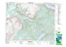
Maps showing Mount Moriah, Newfoundland and Labrador
Mount Moriah is a Town located in Newfoundland and Labrador and has an elevation of 84 meters.
- Latitude: 48° 57' 30'' North (decimal: 48.9583916)
- Longitude: 58° 4' 15'' West (decimal: -58.0708694)
- Topography Feature Category: Town
- Geographical Feature: Town
- Canadian Province/Territory: Newfoundland and Labrador
- Elevation: 84 meters
- Atlas of Canada Locator Map: Mount Moriah
- GPS Coordinate Locator Map: Mount Moriah Lat/Long
Mount Moriah NTS Map Sheets