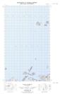
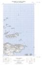
Maps showing Munday Bank, Newfoundland and Labrador
Munday Bank is a Shoal located in Newfoundland and Labrador.
- Latitude: 53° 49' 30'' North (decimal: 53.8249957)
- Longitude: 56° 39' 43'' West (decimal: -56.6619151)
- Topography Feature Category: Shoal
- Geographical Feature: Bank
- Canadian Province/Territory: Newfoundland and Labrador
- Atlas of Canada Locator Map: Munday Bank
- GPS Coordinate Locator Map: Munday Bank Lat/Long
Munday Bank NTS Map Sheets