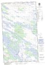
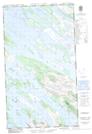
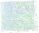
Maps showing Muskrat Lake, Newfoundland and Labrador
Muskrat Lake is a Lake located in Newfoundland and Labrador and has an elevation of 518 meters.
- Latitude: 54° 45' 43'' North (decimal: 54.7618676)
- Longitude: 66° 6' 32'' West (decimal: -66.1088810)
- Topography Feature Category: Lake
- Geographical Feature: Lake
- Canadian Province/Territory: Newfoundland and Labrador
- Elevation: 518 meters
- Atlas of Canada Locator Map: Muskrat Lake
- GPS Coordinate Locator Map: Muskrat Lake Lat/Long
Muskrat Lake NTS Map Sheets