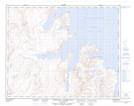
Maps showing The Muzzle, Newfoundland and Labrador
The Muzzle is a Cape located in Newfoundland and Labrador and has an elevation of 315 meters.
- Latitude: 58° 52' 47'' North (decimal: 58.8797721)
- Longitude: 63° 2' 8'' West (decimal: -63.0354406)
- Topography Feature Category: Cape
- Geographical Feature: Peninsula
- Canadian Province/Territory: Newfoundland and Labrador
- Elevation: 315 meters
- Atlas of Canada Locator Map: The Muzzle
- GPS Coordinate Locator Map: The Muzzle Lat/Long
The Muzzle NTS Map Sheets