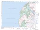
Maps showing The Narrows, Newfoundland and Labrador
The Narrows is a Channel located in Newfoundland and Labrador and has an elevation of 35 meters.
- Latitude: 49° 25' 47'' North (decimal: 49.4297222)
- Longitude: 58° 4' 18'' West (decimal: -58.0716666)
- Topography Feature Category: Channel
- Geographical Feature: Narrows
- Canadian Province/Territory: Newfoundland and Labrador
- Elevation: 35 meters
- Atlas of Canada Locator Map: The Narrows
- GPS Coordinate Locator Map: The Narrows Lat/Long
The Narrows NTS Map Sheets