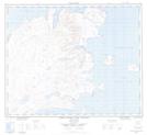
Maps showing Okaliak Island, Newfoundland and Labrador
Okaliak Island is a Island located in Newfoundland and Labrador.
- Latitude: 58° 16' 52'' North (decimal: 58.2811356)
- Longitude: 62° 36' 13'' West (decimal: -62.6037015)
- Topography Feature Category: Island
- Geographical Feature: Island
- Canadian Province/Territory: Newfoundland and Labrador
- Atlas of Canada Locator Map: Okaliak Island
- GPS Coordinate Locator Map: Okaliak Island Lat/Long
Okaliak Island NTS Map Sheets