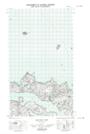
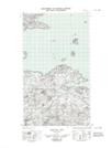
Maps showing Old King, Newfoundland and Labrador
Old King is a Shoal located in Newfoundland and Labrador.
- Latitude: 53° 36' 22'' North (decimal: 53.6062308)
- Longitude: 56° 2' 26'' West (decimal: -56.0406313)
- Topography Feature Category: Shoal
- Geographical Feature: Shoal
- Canadian Province/Territory: Newfoundland and Labrador
- Atlas of Canada Locator Map: Old King
- GPS Coordinate Locator Map: Old King Lat/Long
Old King NTS Map Sheets