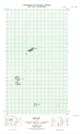
Maps showing Old Man Island, Newfoundland and Labrador
Old Man Island is a Island located in Newfoundland and Labrador and has an elevation of 0 meters.
- Latitude: 54° 9' 23'' North (decimal: 54.1562664)
- Longitude: 57° 20' 55'' West (decimal: -57.3485409)
- Topography Feature Category: Island
- Geographical Feature: Island
- Canadian Province/Territory: Newfoundland and Labrador
- Elevation: 0 meters
- Atlas of Canada Locator Map: Old Man Island
- GPS Coordinate Locator Map: Old Man Island Lat/Long
Old Man Island NTS Map Sheets