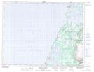
Maps showing Parson's Pond, Newfoundland and Labrador
Parson's Pond is a Town located in Newfoundland and Labrador and has an elevation of 2 meters.
- Latitude: 50° 2' 13'' North (decimal: 50.0369277)
- Longitude: 57° 41' 49'' West (decimal: -57.6969916)
- Topography Feature Category: Town
- Geographical Feature: Town
- Canadian Province/Territory: Newfoundland and Labrador
- Elevation: 2 meters
- Atlas of Canada Locator Map: Parson's Pond
- GPS Coordinate Locator Map: Parson's Pond Lat/Long
Parson's Pond NTS Map Sheets